
Laban Matteson Lot
Historical Cemetery No. 26
West Greenwich, Rhode Island


Surnames:
C[herry]; Matterson; Matteson
20 burials with 10 inscriptions, all proper, from 1828 through 1854
GPS coordinates: 41.62259, -71.62366 (click here to view in Google Maps)
Located 250 feet Southeast of intersection of Big River Road and Weaver Hill Road at Pole No. 66-1/2
45 feet x 50 feet, unprotected; historical cemetery sign in place
Walking Directions:
Begin at public access parking on east side of Weaver Hill Road at intersection with Big River Road at N.E. Co. Pole No. 66-1/2, GPS coordinates 41.64308, -71.62424. Pass under gate and proceed 100 feet west along Big River Road till you see a large sandpit area to your right (south). Cemetery is 200 feet south from Big River Road, at top of hill in center of sandpit.
Diagram
Click diagram to view fullscreen, or here here to open in new tab/window
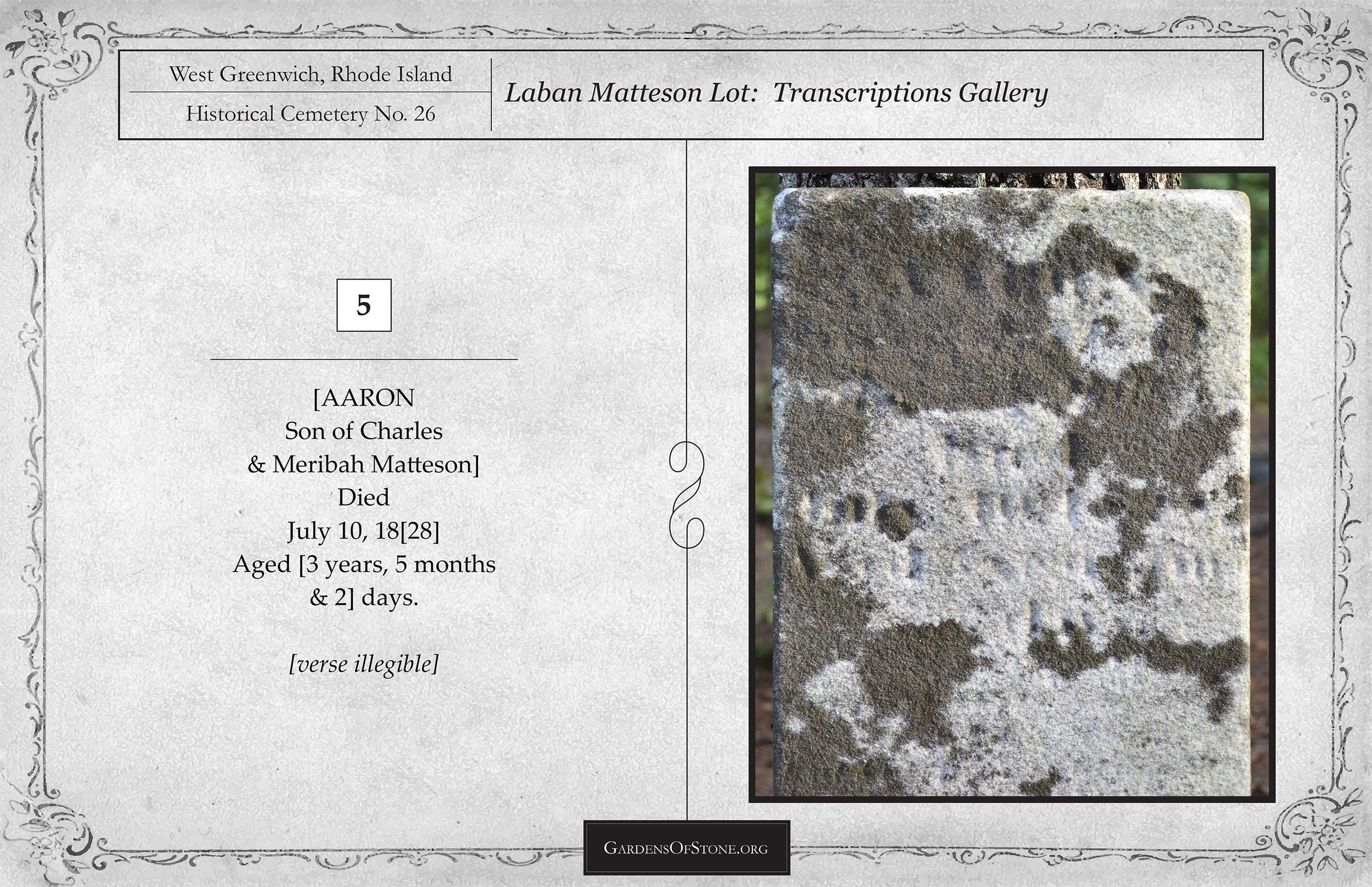
Transcriptions Gallery
Simply click on the burial you wish to view to see fullscreen, or scroll through them to view in order by burial number, as indicated on the diagram above
![( 6 ) H[erbert] O. M[atteson]](https://images.squarespace-cdn.com/content/v1/58caaf051b631b18af89bfcc/1690983368181-WYD59STTMKP1O5PEPX0C/WG026-6f-HOM-Transcription-tmp-new.jpg)


![( 12 ) P[hebe] E[lizabeth] C[herry] / J[ames] W[illiam] C[herry]](https://images.squarespace-cdn.com/content/v1/58caaf051b631b18af89bfcc/1690983373523-1L84W18GB4IT1EZ59H93/WG026-12f-PEC%3BJWC-Transcription-tmp-new.jpg)

![( 18 ) M[eribah] M[atteson]](https://images.squarespace-cdn.com/content/v1/58caaf051b631b18af89bfcc/1690983375497-IPZU8331YL1GAE1GWRX5/WG026-18f-MM-Transcription-tmp-new.jpg)
