
John Matteson Lot
West Greenwich, Rhode Island
Historical Cemetery No. 75


Surnames:
Bailey, M.; Matteson; S.; Shippee; Southwick; Whitford
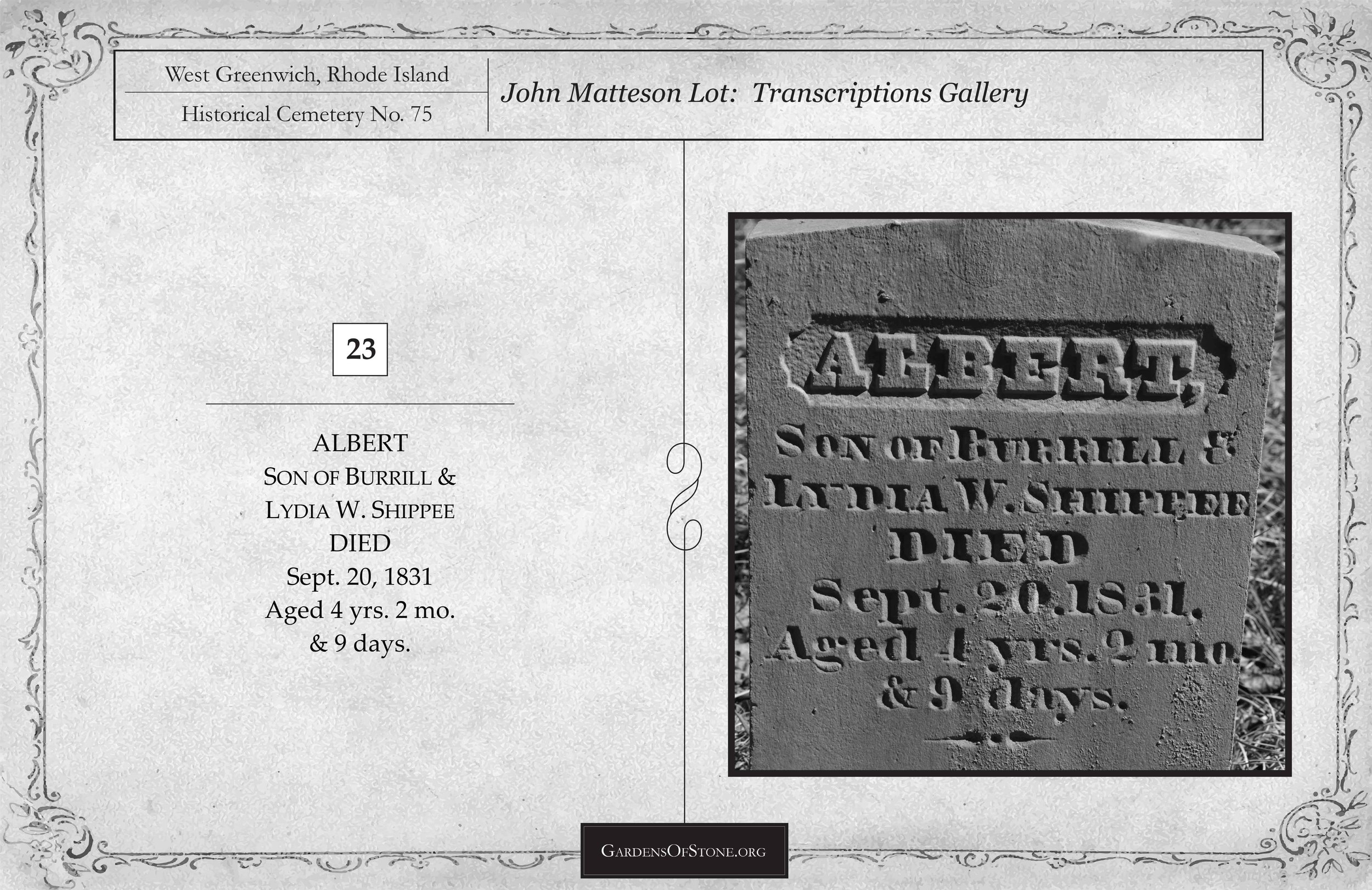
25 burials with 24 inscriptions, 22 proper and 2 rude, from 1776 through 1946
GPS coordinates: N 41 38'04.14" x W 71 37'34.49" (click HERE to view in Google Maps)
Located 180 feet East of Nooseneck Hill Road/Route 3 at N.E.Co. Pole No. 88
70 feet x 60 feet, protected by stone wall; historical cemetery sign in place
Walking Directions:
Park on Nooseneck Hill Road/Route 3 at N.E.Co. Pole No. 88, GPS coordinates, N 41 38’04.90” x W 71 37’37.304”, then walk east 180 feet down the embankment to cemetery at GPS coordinates N 41 38’04.14” x W 71 37’34.49”.
Prior Recordings:
View Blanche F. Albro's [1977] here
Diagram
Click diagram to view fullscreen, or here HERE to open in new tab/window
Transcriptions Gallery
Simply click on the burial you wish to view to see fullscreen, or scroll through them to view in order by burial number, as indicated on the diagram above


* Indicates a previously unrecorded burial